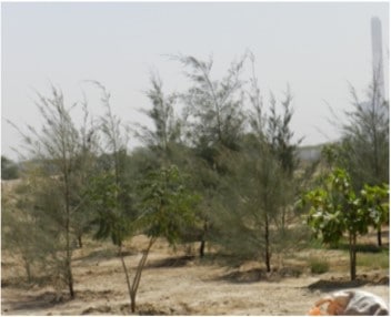
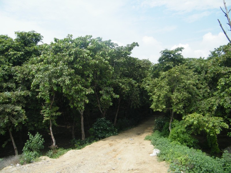
Army Biodiversity Park in Mahipalpur, Delhi (2007) The development of the quartzite ridge in Delhi into a biodiversity park included various watershed management techniques. The planning included water harvesting conservation measures like gully plugging, wetland management and quarry pits management. The plan identified appropriate xerophytic species for re-vegetation of 315 ha with 35000 trees of 40 species. The work also included conservation planning for wetland at Mahipalpur. Plan is being implemented by the Army.
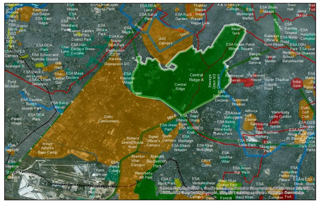
Delhi Cantonment (2013) On the request of Army authorities INTACH has prepared a water management plan for enriching the biodiversity of the 42 sq. km. Cantt. area, where several tubewells are running dry. INTACH has also prepared a Biodiversity Management Plan for the Cantt. area.
Delhi Biodiversity Project Biodiversity inventory and documentation to assess the species and associated landscape information in some selected areas of the capital. The project documents natural features and habitats and delineate them on a base map of NCT Delhi. This is the part of a larger project “Documentation of Natural Heritage of NCT, Delhi and preparing Urban Biodiversity Plan”. The objective of the Plan was to ensure that the natural heritage of Delhi is taken into consideration in the mid-term planning review of NCT Delhi’s Master plan. Thereby, taking a substantial step in urban nature conservation, eco-system services and sustainability.
Aravalli Biodiversity Park (2017) IUCN entrusted INTACH to carry out a biodiversity assessment (392 acres) of Aravalli Biodiversity Park, Gurgaon. The Biodiversity Park is an endeavour of Muncipal Corporation of Gurgaon and NGO Iamgurgaon to create a forest ecosystem in order to rejuvenate flora which is native to the ridge.
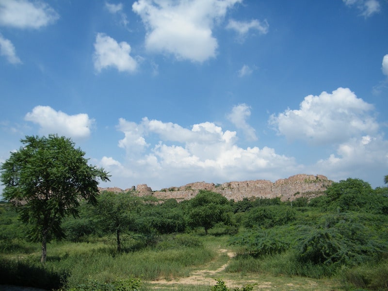
Documenting The Natural Habitat And Biodiversity In Heritage Premises (2014) Heritage sites such as sprawling forts offer refuges for biodiversity amidst hard urban development. INTACH initiated a study whereby biodiversity of Adilabad Fort, Tughlaqabad Fort, Siri Fort and Jehanpanah Forest was surveyed. Mapping these sites suggested that precincts could be linked to each other in the form of patch corridors.
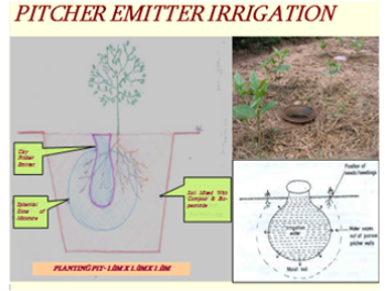
Coastal Gujarat Power Ltd (Tata Power) Mundhra, Kutch (2009-12) Planning of green belt and afforestation areas over 10 sq.km. The plan included creation of habitat for rare, endangered and threatened species, and for generating employment opportunities for villagers as a CSR component. Macro water harvesting was implemented. Over 50,000 trees of 65 species were planted using pitcher irrigation. High survival rate and return of faunal biodiversity was achieved. Subsequently, similar exercises was carried out for Dahej SEZ Ltd., Gujarat.
Maithon Power Ltd (Tata Power), Jharkhand (2013-14) A diverse mixed of plant species including bamboo were planted as part of the environmental offset programme.
Urban Biodiversity Plan (Jaipur) (2017)
Biodiversity mapping and assessment work for Jaipur is the project endeavour to map habitats, Biodiversity, Wetlands, Natural features which could be integrated with Master plan of city for incorporating Eco-sensitive decision making at policy level.
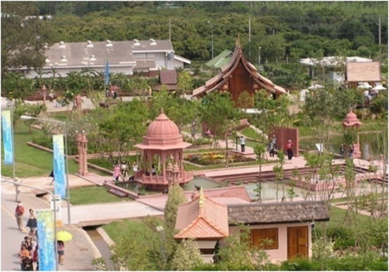
Indian Garden, Chiang Mai, Thailand (2006-07) Indian Govt. created a traditional Indian Garden in honour of the Thai King on a half acre site as part of an International Garden Expo. The design and construction management of the garden was coordinated for this project of value Rs. 1.60 crore. The work included coordinating with the landscape architect, arranging traditional stonework elements, including chhatris, to be made at Bikaner, shipping materials from India, appointing contractors in Thailand, supervising the work including the vegetation elements, all in a period of 120 days. [through INTACH].
Transforming Noida And Its Extended Environs Through An Eco-System & Landscape Approach Towards A Sustainable And Naturalized Entity (2019-20) The study attempts to understand the natural conditions of the NOIDA region and offer a plan to modify those conditions within the existing urban fabric to ensure greater climate change resilience and sustainability. It also offers a GIS map in several thematic layers showing the various interventions proposed, which can be used by policymakers and stakeholders for effective and eco-sensitive decision making.
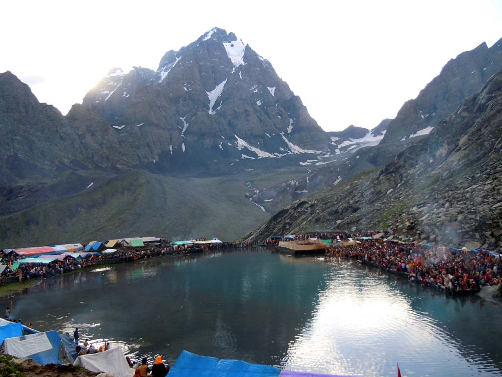
Manimahesh (2015) INTACH took initiative to study the social, cultural and environment impact on sacred landscape of Manimahesh. The Himachal Pradesh Govt took interest and further directed to prepare DPR for the facilition of Yatra routes facilities and conservation of lake.
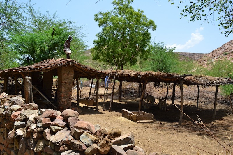
Village Environmental Plan For Village Dumoda In Sawai Madhopur (2017) The project focus on documenting the environmental assets and natural resources at village level. Assimilation of quantitative and qualitative analyses helped in creating natural resources and energy budget. Thereby, formulating an environmental plan for Dumoda village. The second phase of the project constitutes the implementation of the plan.
Natural Heritage Listing Natural Heritage includes all components of our surroundings which have not been by man which are cultural, aesthetic, spiritual biotic or ecological value and which could be of directly usable resource value. It is important to document such areas to draw conservation lines for them. NHD with support of various chapters carried out NH Listing. At district level listing of Sawai Madhopur , Nalanda, Champaran, Darbhanga, Dausa and Jammu has already been carried out.
Mapping, Documentation & Planning The Regional Landscape Of Natural Heritage of Faridabad & Gurgaon District The Faridabad & Gurgaon districts are populated and industrialised setup in the Delhi NCR. Growing number of industries, housing colonies and infrastructures have engulfed many forested areas and water bodies. The focus has always been on protected areas but perhaps much more lies outside of them, unprotected and therefore vulnerable to being swallowed for other development uses without their ecological significance being factored in. A documentation was carried out to assess the condition of the remaining natural heritage features of this region. The study further helped in identifying vulnerable features and the conservation actions that need to be put on place to safeguard such areas.
Mapping, Documentation & Planning The Regional Landscape Of Natural Heritage In District Of Western Desert (Jaisalmer, Jodhpur, Bikaner, Barmer) This is a three year project that will enable administrators to harmonize development with ecology.
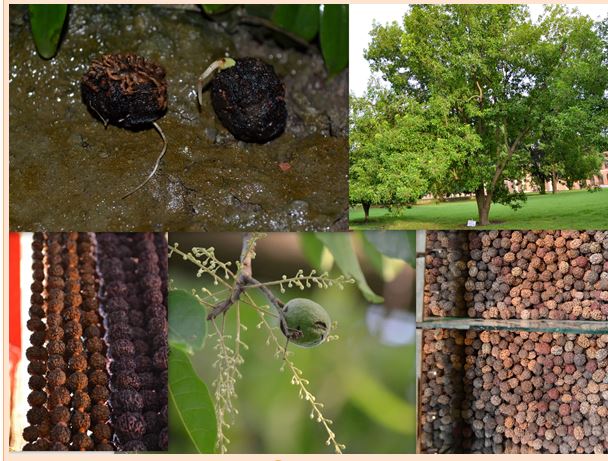
Rudraksha Documentation of the status of Rudraksha tree covering aspects like distribution, occurrence, ecological status, threats along with research conservation techniques has been done. The study examined scientific possibilities of planted propagation by habitat conservation and enhancement. Plantation initiative has been implemented in Bhiri village, Uttarakhand with support from Forest Department, Uttarakhand. As a follow up the planting of Rudraksha saplings has been taken up in Uttarakhand. With a target of 10,000 trees
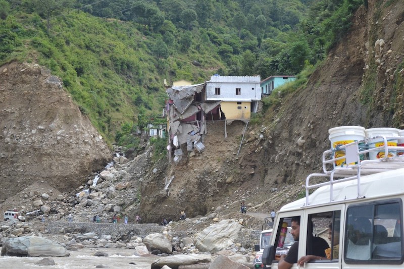
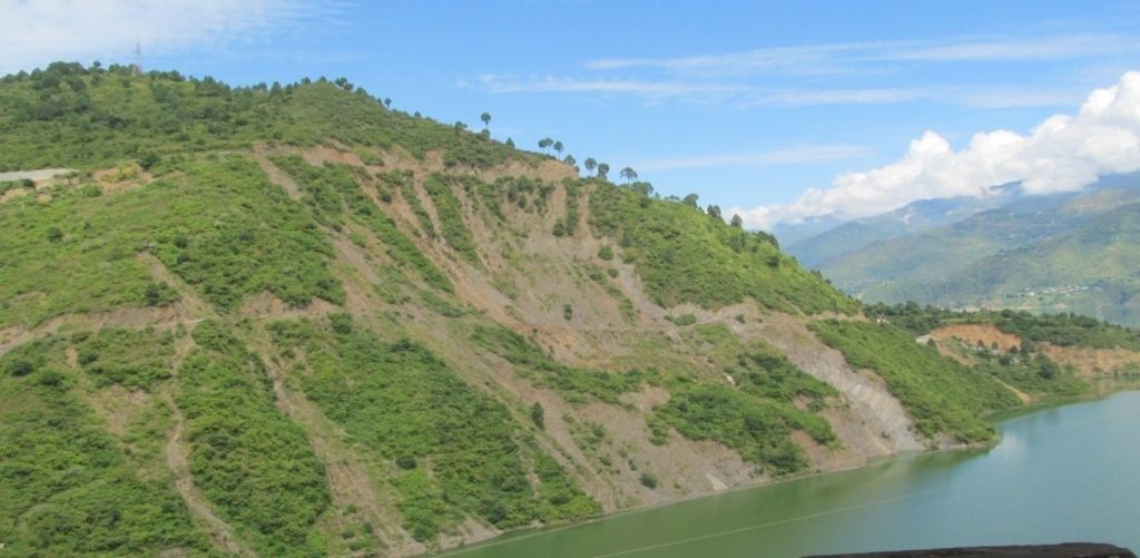
Uttarakhand Disaster Relief Project INTACH is undertaking interventions in disaster affected Bhiri Village, Uttarakhand. A three day rescue and first aid training was organized for school children and volunteers [total 80 persons] administered by National Civil Defense Agency. Further, INTACH handed over a specialized professional rescue kit to the Mahila Mandal. INTACH has also helped in strengthening and expansion of existing government school building. Landslide debris was converted into building blocks and was used for building.
Upper Ganga Region Cultural Resource Mapping An inventory of Heritage sites in the Ganga Region of Uttrakhand state covering District of Haridwar, Roorkee and parts of Tehri.
Documentation of Old Bridges of Uttarakhand An all Uttarakhand Listing of old cable and girder bridges has been completed so that many of these bridges that has been now obsolete can be preserved.
Exploratory Foray in The Upper Yamuna Region A study was carried out in the upper reaches of Yamuna & Tons Valley in the winter of 2012 documenting heritage and culture.